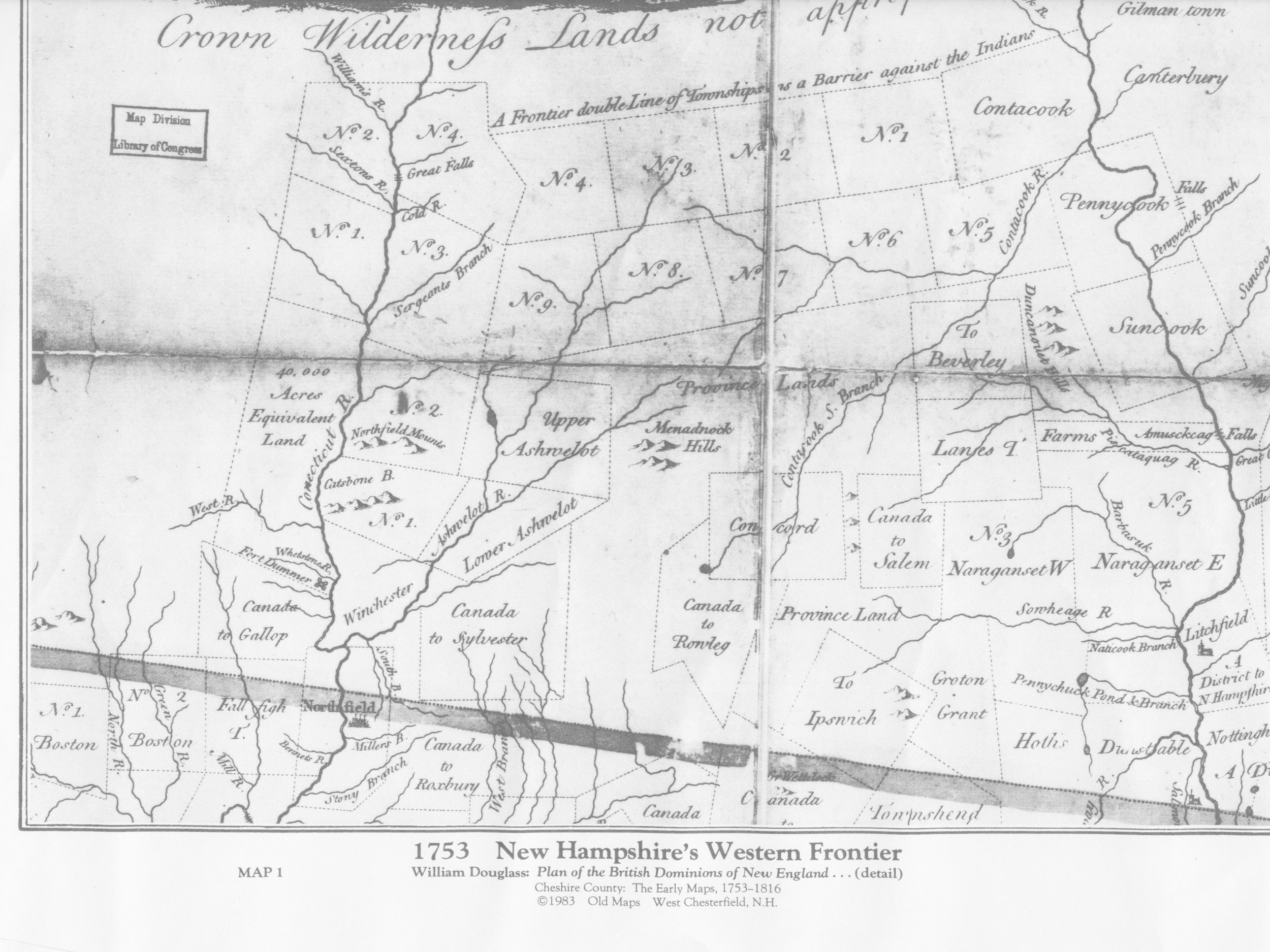
1753 Map of NH's Western Frontier courtesy of Historical Society of Cheshire County
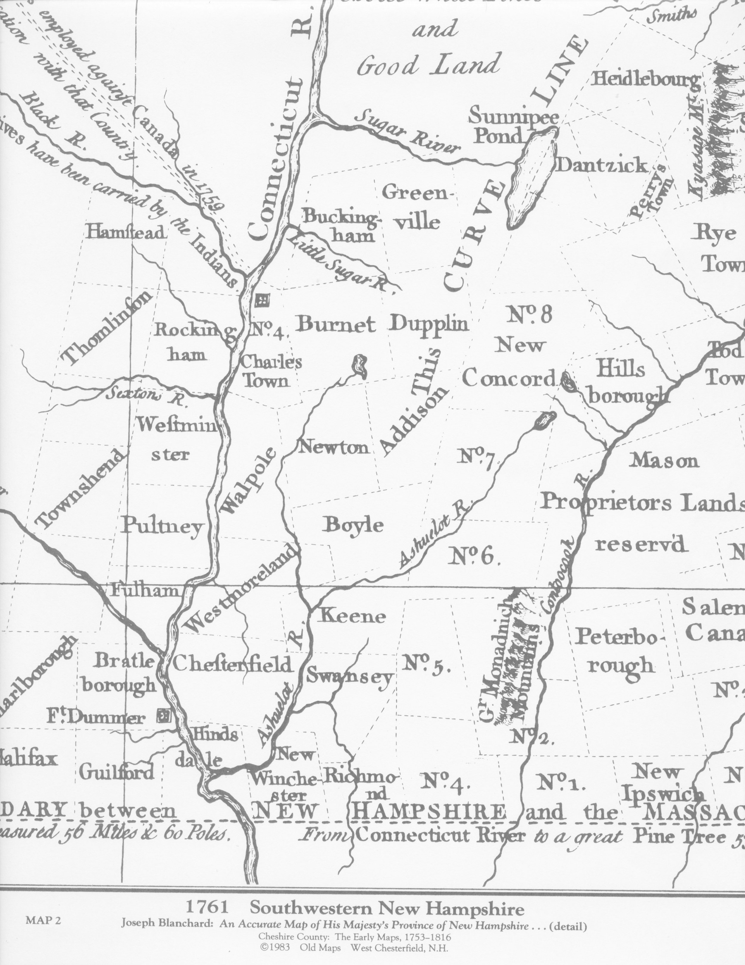
1761 Map of Southwestern NH, courtesy of Historical Society of Cheshire County
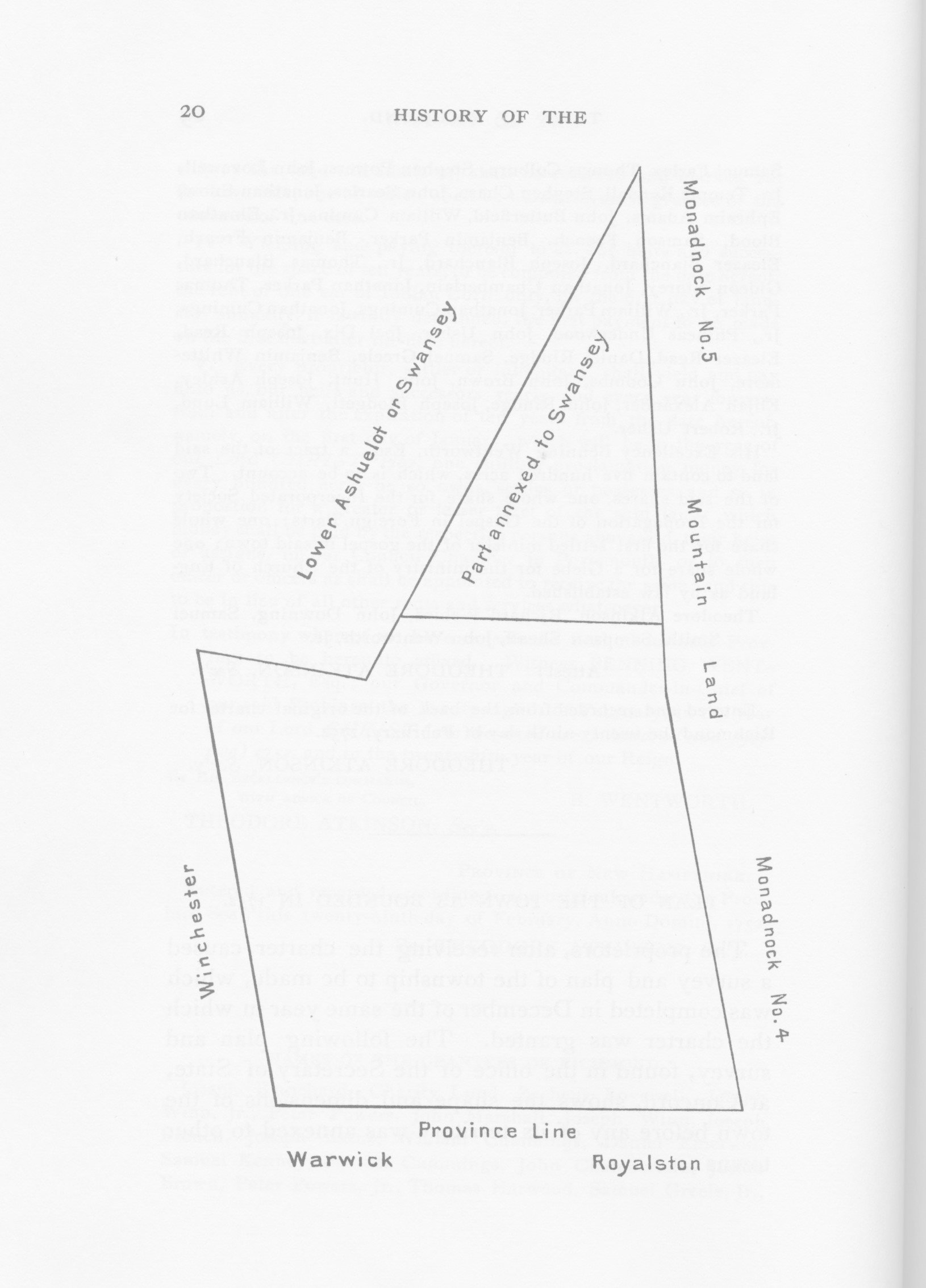
1762 Annexation to Swanzey, from Bassett's "History of Richmond".
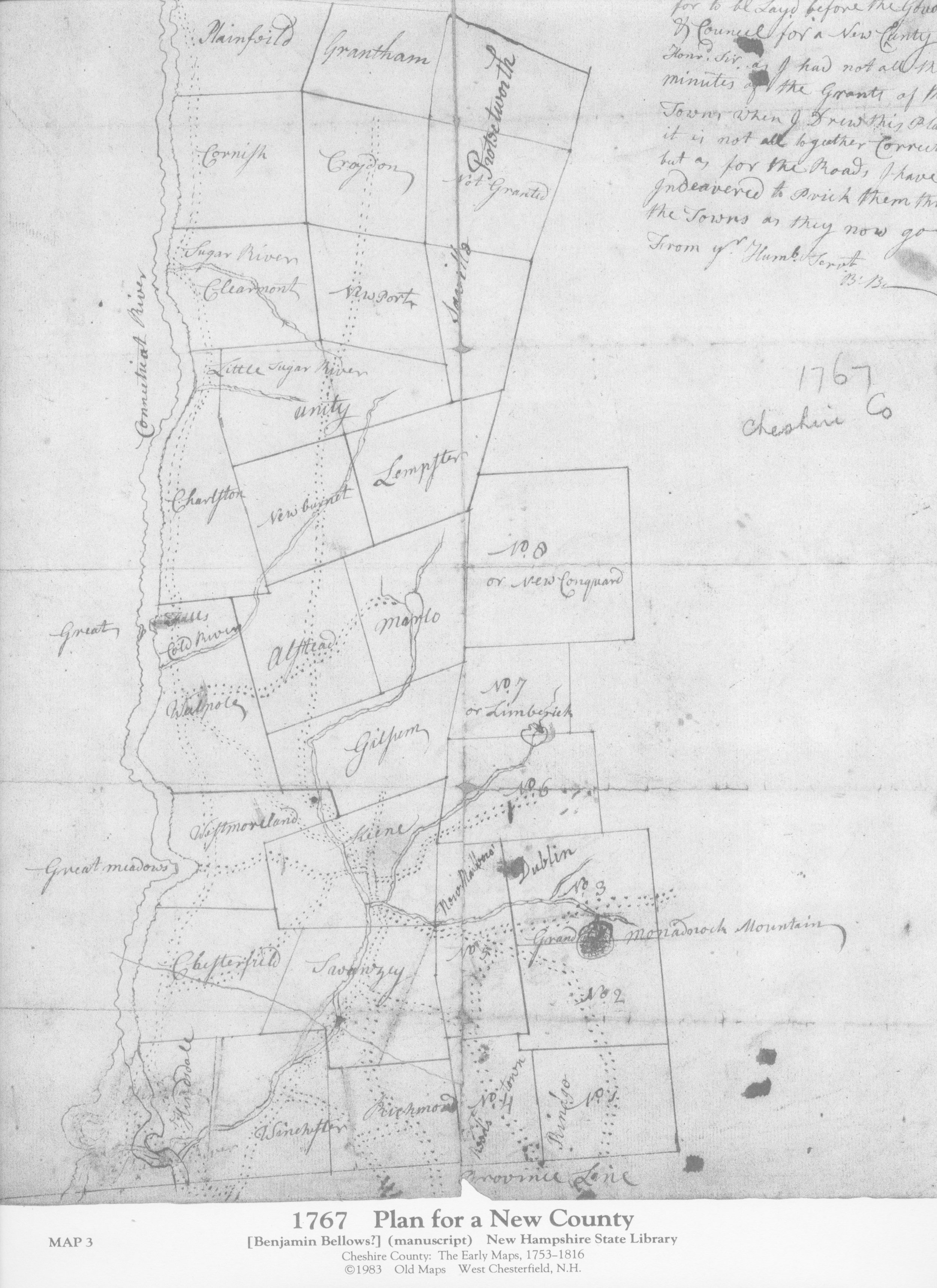
1767 Map of Plan for Cheshire County, courtesy of the Historical Society of Cheshire County
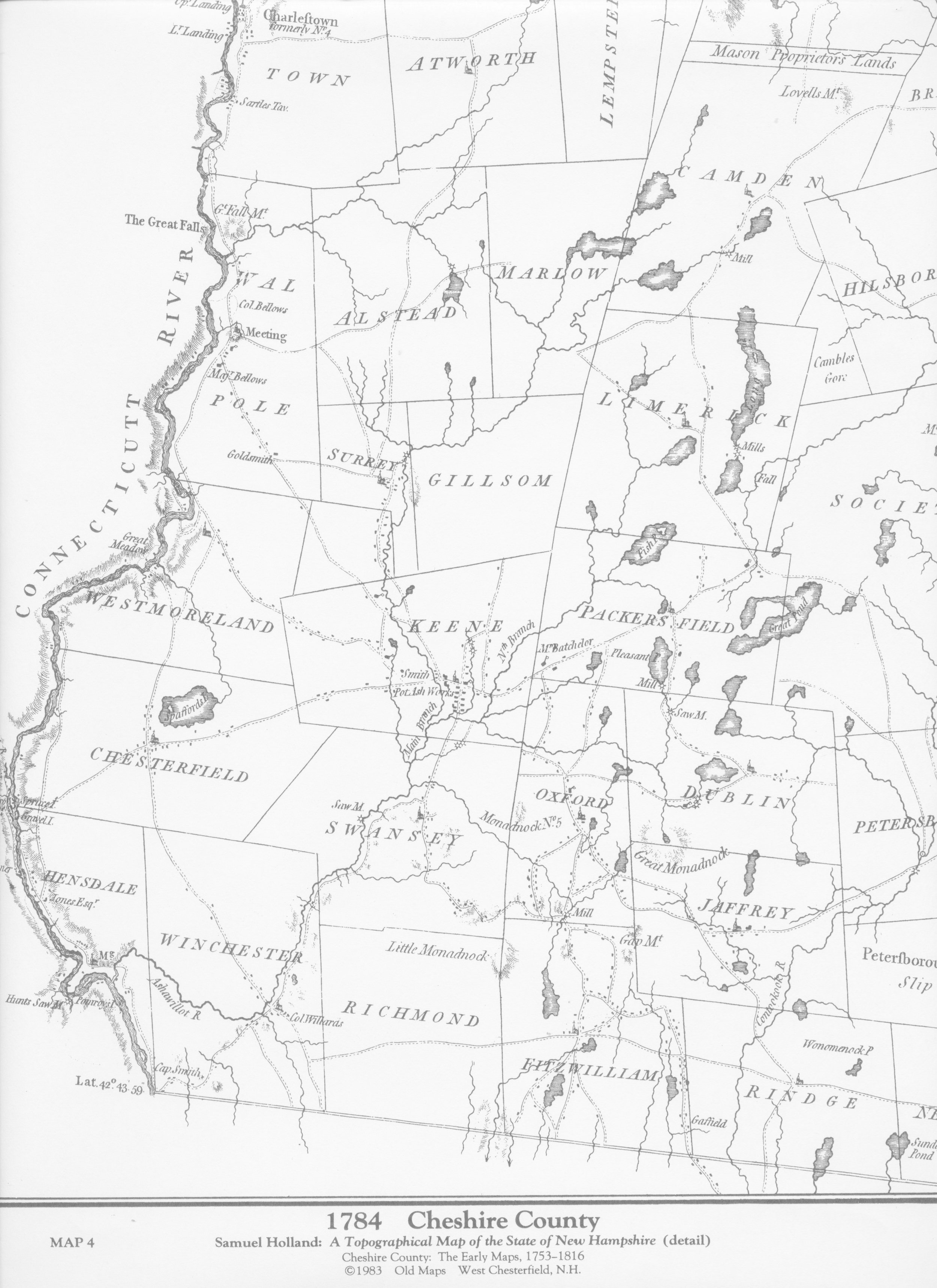
1784 Map of Cheshire County, courtesy of the Historical Society of Cheshire County
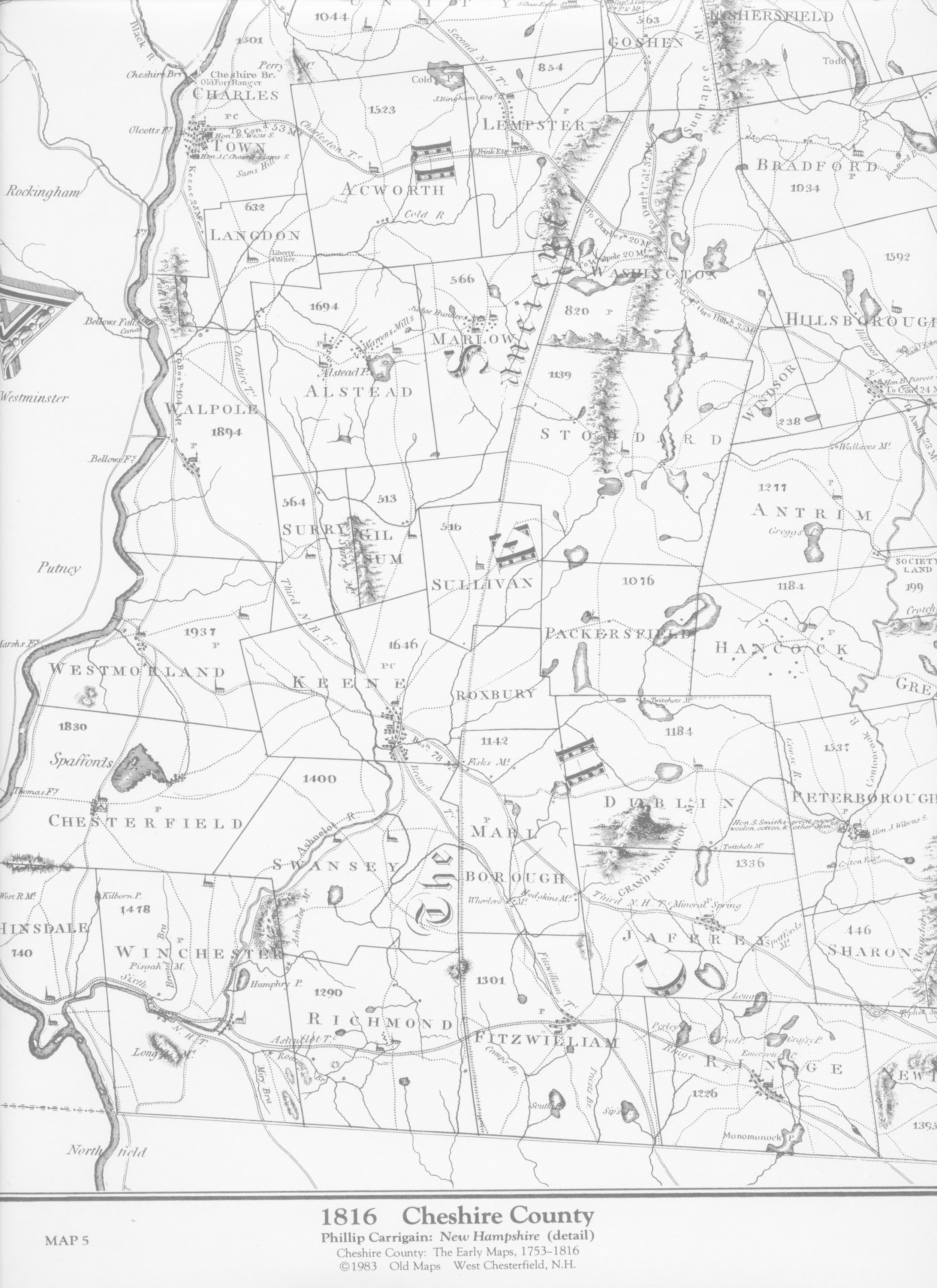
1816 Map of Cheshire County, Courtesy of the Historical Society of Cheshire County